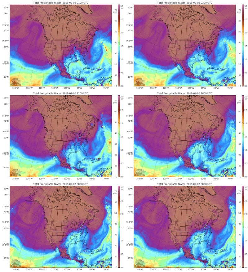
Now that I have a name for the plumes, I can go ahead with a report, just like the currents. An ARS is a 'thing'. It has energy, momentum, vector velocity, and moves a lot of heat energy around. Figurative terms just as 'jet stream', or 'polar vortex' are just eye candy for tv weather people.
The daily map for these is here. You can see the heat energy pumping around the world.
That river hitting Alaska is giving us an old pattern for the Arctic Ocean.
The last 20 years have had this warming over Alaska and that has reduced the ice volume. But this is a very tiny river, and will soon dry up.
Now, this super-river hitting North America is remaining in one place and flooding us with icy warmth. I've never seen this.
It's extracting heat from the Gulf of Mexico, and we don't know how fast the currents can replenish it. I find the pattern amazing.
The UK should get some warmth if those Atlantic rivers maintain their push up north, but it looks like they could run out of energy, trying the penetrate the cold. That would be good news for the Scottish ski resorts. :)
The ice patterns in the creek are nice. You need big ice spikes to walk there.
ps. the good news is that this big river has carried us out of January, and our February default weather has gone up to -10. Yeah!
pps. this is the local school yard this morning. A Zamboni couldn't get it better.


No comments:
Post a Comment