Sorry everybody for the Mastodon excursion, but I'm cut off now. Nobody cares about my 3 readers here, and if they made a stink, it would go up to 6 readers.
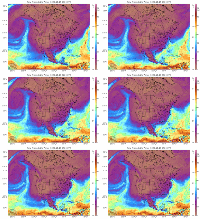
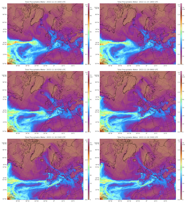
MIMIC is showing very weird tropical plumes. The reasoning behind the physics forecast is that moist air holds 1000 times the heat energy of dry, and water holds 1000 times over air. That's rough, but you can calculate that yourself (Ha!).
The Pacific plumes are going straight up, like shark fins. Nobody keeps a history of this stuff, but I've never seen it before. That means NA is being showered by Arctic air.
At least, noosa got the rocket off.
Europe is being hit by a huge cold air blob. Might eat a bit into their natgas storage. The Atlantic plumes are finally running out of steam.
Next article, we confirm the 1 to 5 year forecast, when the ocean current map is out. The Scientific Method treats a forecast as a hypothesis, and it passes or fails. The calculated uncertainties swamp any forecast beyond a year or two, because that is the residence time of ocean currents. The concept of a 50 year hypothesis or forecast is not within the SciMeth.


No comments:
Post a Comment