I'm on and off with Mastodon. A blog like this maintains and archive, and social sites don't.
In today's video we see the difference a little shift makes. The last cyclone was a bit more south and just sucked in Arctic air over the UK. This one is up a bit and changes the wind patterns. The cyclone is fed with energy by a constant Atlantic plume.
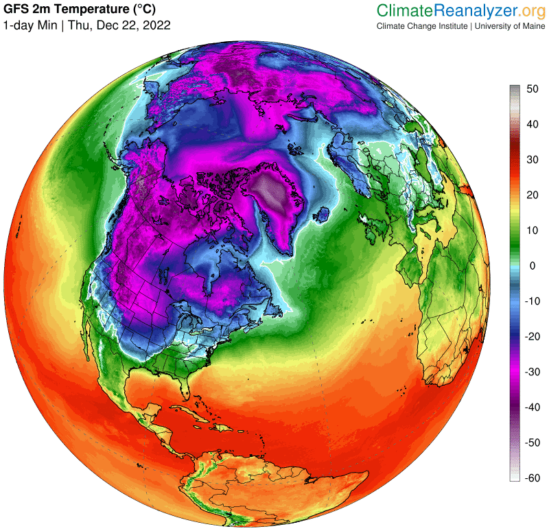
This cold blob about to consume Toronto comes from a total lack of heat energy from plumes. It is what we would expect when the ocean heat engine shuts down. Friends of ours are romping in Saskatoon at 50 below. This blob is bypassing the Great Lakes and coming at us from underneath. That turns Toronto into Buffalo. Hopefully, it's all rain again but I doubt it.
2 comments:
I saw this and thought of you....
https://www.dailymail.co.uk/news/article-11568587/Midwest-colder-MARS-millions-grounded-2-500-flights-cancelled-already.html
Neat, I hope they realize this is the new future. Hope you got some rain.
Post a Comment