Saturday, July 27, 2019
Arctic ice volume starts a strong cut
This is great news on a very hot day. The Gulf air is continuing to hit Toronto, but the Pacific air is coming straight west. Don't know what that means. Usually means dry, cooler air.
The ice volume plot shows the end of that long El Nino. Lasted a whole year, but it was a small peak. The monthly world temps should show a drop. Meanwhile, the UK is enjoying cold air for the summer, after a one-day heat wave. When the El Nino ends, they'll finally know what the Gulf Stream did for them all these years.
ps. this is plain silly, but they never retract.
Reference
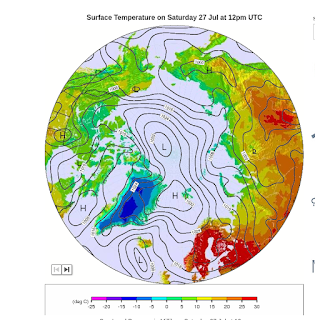
You can see that the Europe heatwave plume is about to be strongly turned back. The rest of Europe is in stagnant air, so it will be hot. I always wonder what happened to those guys from nasa who published that the Greenland glaciers were advancing. They must have got 'the cold shoulder'. :)
Greenland remains an ice paradise.
Subscribe to:
Post Comments (Atom)


No comments:
Post a Comment